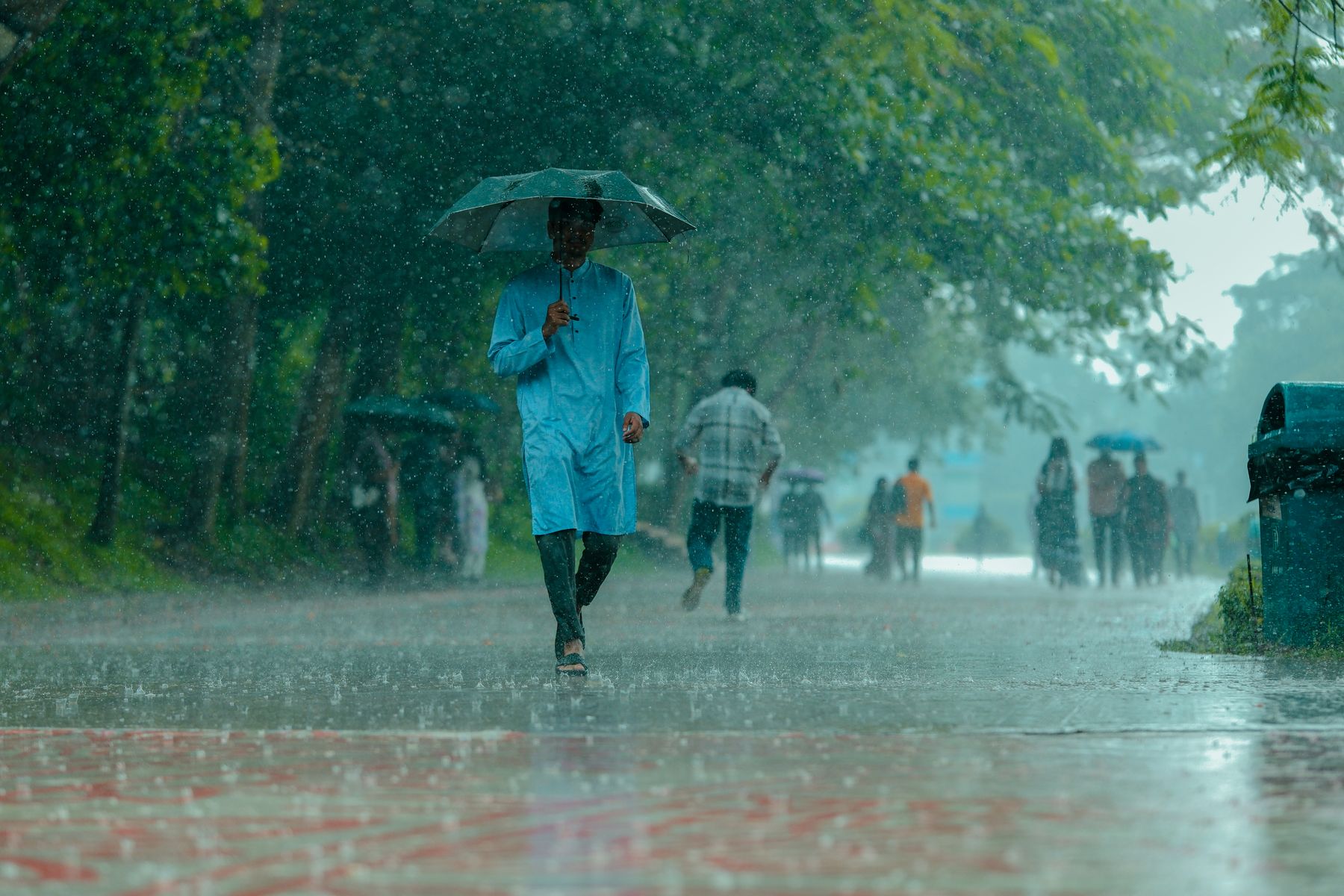
Thailand Monsoon Rainfall
Thailand’s monsoon climate is driven by seasonal wind shifts that move moist air from the ocean toward land. When those winds strengthen, rainfall becomes more frequent and more intense in many areas, but the timing and severity vary by region because coastlines, mountain ranges, and distance from the sea change how storms form and where they drop water.
For travel planning, the key is not just “rainy season,” but the local pattern: short downpours versus multi-day wet spells, stormy afternoons versus steady drizzle, and how often heavy rain coincides with high winds that disrupt ferries. A practical example: a Bangkok itinerary can feel wet mainly as brief showers between sunny periods, while the Andaman coast can experience longer periods of rain and rougher sea conditions during the same months.
Rainfall also interacts with elevation. In the north, higher areas can receive more frequent cloud and rain as moist air is forced upward by mountains, while lowland plains may see more intermittent showers. This is why two trips in the same month can feel very different even when the calendar says “monsoon.”
Where Travelers Misread Rain
Many travelers treat monsoon rainfall as a single national schedule. Thailand’s weather is regional: the Gulf of Thailand coast, the Andaman coast, and the northern interior respond differently to the monsoon flow and to local storm tracks.
Another common mistake is relying on a single “chance of rain” number. Forecasts often update hourly, and the probability can change quickly as storms shift. A 60% chance can still mean a short shower, while a 20% chance can still include a heavy burst if a storm cell passes near your route.
People also underestimate how rain affects transport. Heavy rain can reduce visibility and increase river and road flooding risk in some areas, while strong winds matter more for islands and coastal crossings than for inland cities. If your plan depends on boats, the limiting factor is frequently wind and wave height rather than rainfall totals.
Supporting technologies help, but they have limits. Weather models and satellite products can show where rain is likely, yet they cannot guarantee exact timing at street level. Even with good tools, a last-mile plan still needs a buffer—especially when you schedule day trips that require crossing water.
As a small aside, I often see travelers check forecasts on a phone app version that still labels “monsoon” by month rather than by current conditions; the wording can lag behind the data feed. On 2026-10-19, for example, many apps still show different update intervals for radar and precipitation estimates, which changes how quickly you notice a storm moving in.
Plan by Region and Timing
Andaman Coast: Stormy Windows
The Andaman side (including Phuket, Krabi, and nearby islands) often faces monsoon-driven wet weather when winds shift from the southwest. Rain can arrive in bursts, and the sea can become rough enough to affect ferry schedules. Travelers usually experience a mix of heavy showers and breaks, but the “breaks” can be short when storm bands linger.
Practical planning steps: check coastal forecasts that mention wind and wave conditions, not only rainfall. If you book island transfers, build in a same-day alternative route or a land-based buffer day. When you see repeated warnings for strong winds, treat it as a transport constraint even if the rain looks brief on land.
Realistic outcome expectations: you may still get several dry hours, but you should plan for frequent interruptions. A day trip that depends on multiple crossings can become unreliable even when your hotel area looks fine.
Gulf Coast: More Consistent Wet
The Gulf of Thailand coast (including Koh Samui, Koh Phangan, and parts of the east) often has a different monsoon timing than the Andaman side. Rainfall can be frequent, and storms can develop offshore and move inland. Coastal areas may see more regular wet spells, while inland routes can remain more manageable between showers.
What to do: schedule outdoor activities for mornings and keep a flexible indoor option for afternoons. Use radar-based views when available, since they show whether rain is approaching your specific district. If you are traveling with children or anyone sensitive to slippery conditions, plan for wet sidewalks and consider footwear with good grip.
Realistic outcome expectations: you can still travel comfortably with short rain breaks, but you should expect humidity and intermittent downpours to shape daily timing.
North and Northeast: Mountain Effects
In northern Thailand, monsoon moisture interacts with mountain terrain. Cloud and rain can be more frequent in upland areas, and fog or low visibility can occur during heavier wet periods. The northeast (Isan) is drier than the far south in many months, but it still receives monsoon rainfall that can cause localized flooding in low-lying areas.
What to do: if you plan hikes or viewpoints, check forecasts for both rain and visibility. For road travel, watch for flash-flood risk after intense showers, especially near streams and in areas with poor drainage. If you are visiting temples or rural sites, plan extra time for detours when roads are temporarily closed.
Realistic outcome expectations: rain can be patchy. One valley may be soaked while another stays passable, which is why route-level radar matters more than province-level summaries.
Bangkok and Central Plains
Central Thailand often experiences monsoon rain as showers that can be intense but short-lived, mixed with periods of sun. Urban flooding risk depends on local drainage and storm intensity; heavy rain over a short time can overwhelm small canals and low-lying streets.
What to do: plan around commute times and avoid scheduling long outdoor stretches during the most likely storm hours. Use live precipitation maps to decide whether to postpone a walking segment. If you rely on rideshare or public transit, keep a backup route in mind because traffic patterns change quickly during downpours.
Realistic outcome expectations: you can often continue a city itinerary, but you should expect wet surfaces and sudden weather shifts.
Educational Case Examples
Example 1: Andaman Island Transfer
An anonymized traveler planned a Phuket-to-island day trip during a week when forecasts showed higher wind risk. Rain on land looked intermittent, but the coastal forecast repeatedly flagged rough sea conditions. The traveler shifted the crossing to a morning slot and added a land-based activity as a fallback. The trip still included a short shower, yet the revised plan reduced the chance of losing the day to canceled boats.
Example 2: North Thailand Route Choice
A different anonymized traveler planned a northern loop with a viewpoint stop and a waterfall visit. Province-level forecasts suggested “rainy,” but radar showed the heaviest band moving through one corridor earlier than the other. The traveler moved the viewpoint to the morning and kept the waterfall for later, when the rain had eased. The route remained safe and passable, though the waterfall area had slippery paths and required slower walking.
Rainfall Planning Checklist
| Travel Region | Typical Monsoon Feel | What to Check Daily | Planning Buffer |
|---|---|---|---|
| Andaman Coast | Frequent wet spells; sea conditions can worsen | Wind/wave warnings plus radar rain bands | Add 1 flexible day for boat changes |
| Gulf Coast | More regular rain; storms can move inland | Radar timing and local downpour intensity | Plan outdoor mornings; indoor afternoons |
| North | Mountain-driven cloud and rain; visibility varies | Rain plus visibility/low-cloud indicators | Keep extra time for detours |
| Central Plains | Short intense showers; urban drainage matters | Live precipitation and commute timing | Avoid long outdoor blocks during peaks |
Step-by-step checklist for the day you travel: 1) Check a radar view for your exact districts, not just the province. 2) If you cross water, check wind and wave warnings. 3) Schedule the most weather-sensitive activity for the morning. 4) Carry a compact rain layer and shoes with grip for wet sidewalks. 5) Keep one indoor option within walking or short transit distance.
Common Mistakes to Avoid
Booking a tight multi-leg island itinerary with no buffer is the most frequent planning error. Even when rain looks manageable, wind can trigger delays or cancellations. A second mistake is assuming that “rainy season” means constant rain; monsoon periods often include breaks, so you can plan around them if you check conditions close to departure.
Another issue is ignoring local road and drainage behavior. After heavy showers, some routes become slow or temporarily impassable due to flooding or mud. If your plan includes rural areas, add time for detours and avoid scheduling a single fixed arrival window.
People also overpack for the wrong problem. A thick jacket may be less useful than a light waterproof layer and quick-dry clothing in humid conditions. And if you rely on an offline map, remember that GPS can still work during rain, but traffic and route changes may not match what you cached earlier—frankly, most people skip the “offline update” step.
FAQ
When Does Monsoon Rain Peak?
Monsoon rainfall peaks vary by region because wind patterns and storm tracks differ across Thailand. Use local forecasts for your specific dates rather than relying on month labels alone.
Which Coast Gets Rougher Seas?
The Andaman coast often faces more frequent monsoon-driven wind and wave issues during the southwest monsoon period. Check ferry operator advisories and coastal wind/wave forecasts before booking.
Will Bangkok Always Be Wet?
Bangkok commonly sees short, intense showers mixed with drier periods. Urban flooding risk depends on storm intensity and local drainage, so live precipitation checks help.
Is It Safe to Hike in the Rain?
Rain increases slip risk and can reduce visibility in mountainous areas. Choose routes with safer footing, start earlier in the day, and avoid steep trails during heavy downpours.
How Should I Track Rain Day-To-Day?
Use radar-based precipitation views and check updates close to departure. For water crossings, prioritize wind and wave warnings over rainfall totals.
Author's Insight
Thailand’s monsoon rainfall pattern is best understood as a regional system shaped by seasonal winds, coastlines, and mountains. Travelers often misjudge risk by treating “rainy season” as a single national event, then planning without checking radar timing or transport constraints like wind. Practical planning works when you match your activities to the limiting factor: rain for walking and hiking, and wind/waves for ferries. Tools such as radar precipitation maps and coastal wind forecasts can reduce uncertainty, though they cannot guarantee exact conditions at your exact street corner.
Key Takeaways
- Monsoon rainfall varies by region; coastlines and mountains change where storms drop water.
- Check radar timing and, for islands, wind and wave warnings—not only “chance of rain.”
- Plan weather-sensitive activities for mornings and keep a same-day indoor or land-based fallback.
- Add buffer time for transport that depends on sea conditions and for routes prone to flooding after heavy showers.